Blog
Updated 4/16/22 at 1730 AKDT / 2030 CDT
Most recent days are listed first
-- Thursday, April 14, 2022 -- Day 5 -- Final Day
Flight leg 7 - Ketchikan, AK [PAKT] to Yakutat, AK [PAYA]
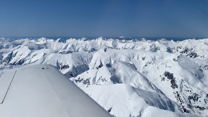
Today - the final day - was excellent. It was an exceptional day for weather from southcentral Alaska all the way down through the panhandle.
I asked several locals in Ketchikan: "How many days a year do you have super clear skies like this?" Most said something close to "Maybe 20 days a year".
And for it to be this way all the way to Anchorage - I feel I was quite lucky.
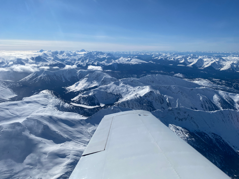
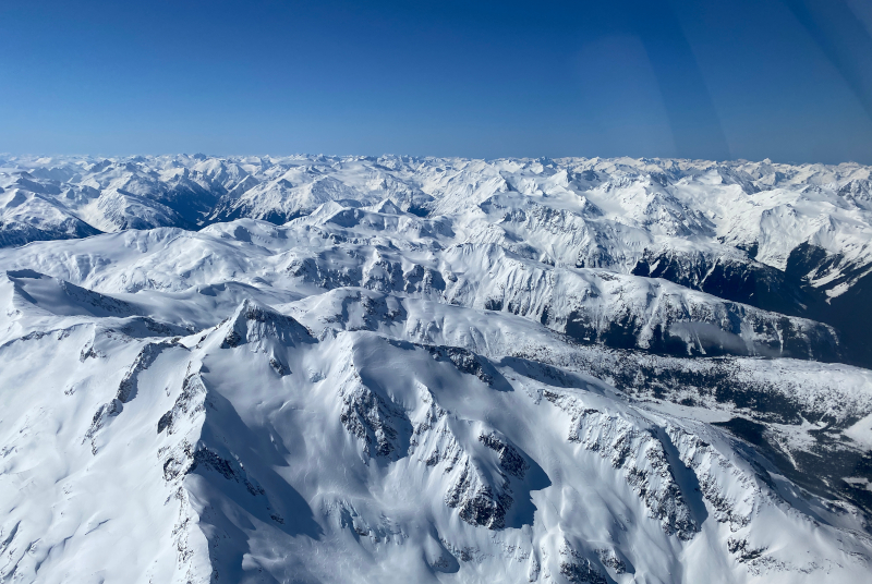
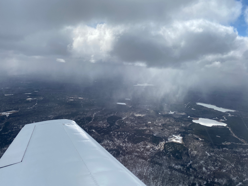
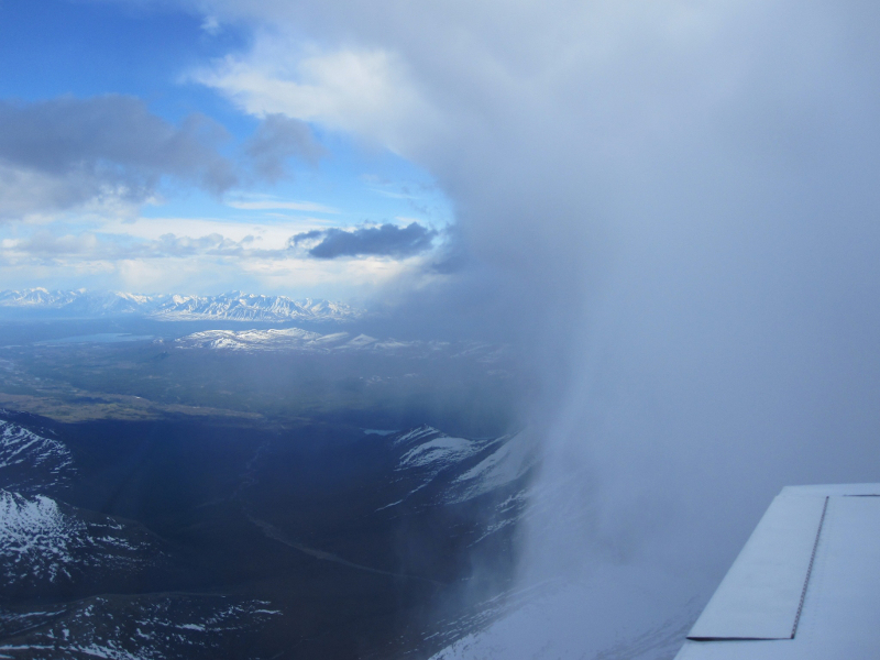
Completely clear in southcentral and southeast Alaska!
Look at the extremes- completely clear along my route
and a nasty low pressure over the Bering Sea
I normally don't talk a lot about food, but last night's dinner (halibut) and this morning's breakfast were outstanding.
The view from the hotel and its restaurant were also great. (I'm going to run out of superlatives today...)
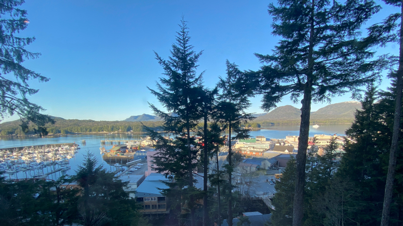
The awesome view from the Cape Fox Lodge restaurant
My two favorites: Mountains and ocean views
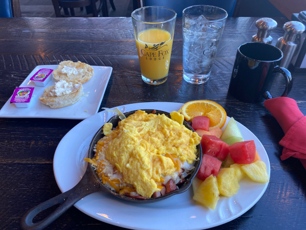
The "Alaskan Tundra Skillet"
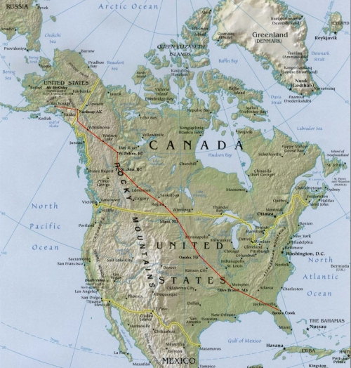
Before we depart let me share a little bit of geography. The first image is an overview of today's route and then one zoomed in to show the
location of a few significant mountains and glaciers I'll be mentioning (with photos).
Mt. Fairweather is interesting since it's at the point where Alaska's southeast panhandle is narrowest - only 15 miles from Canada to the Pacific Ocean.
Mt. St. Elias at 17,890' is at the "corner" where the Alaska panhandle begins, bordering on the southwest corner of Canada's Yukon Territory. Mt. St. Elias is the second tallest mountain in both the US and Canada.
Of course, the tallest in the US and North America is Denali at 20,310'. Canada's tallest is Mount Logan at 19,501'.
I've found that different sources quote slightly different elevations for various mountains, but I'm using the elevations published on aeronautical charts.
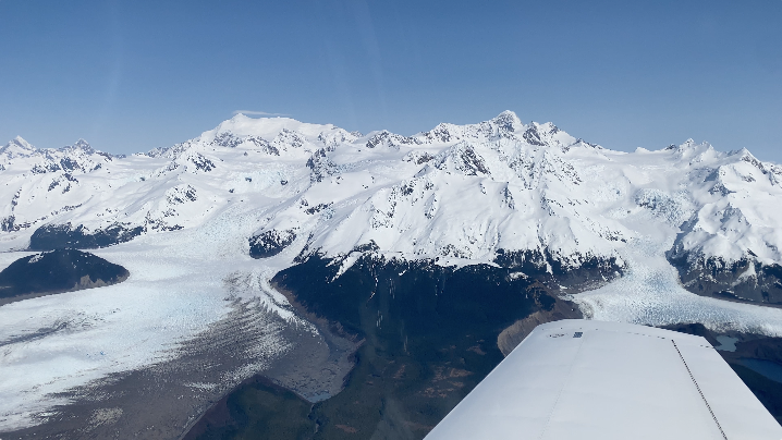
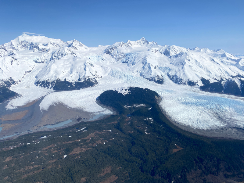
The Malaspina Glacier is approximately the same size as Rhode Island. The Bering Glacier combined with the Bagley Icefield, where the snow that feeds the glacier accumulates, is the largest glacier in North America. Photos of each of these features follow.
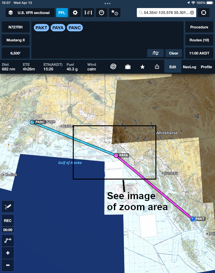
Today's route from Ketchikan to Yakutat to Anchorage
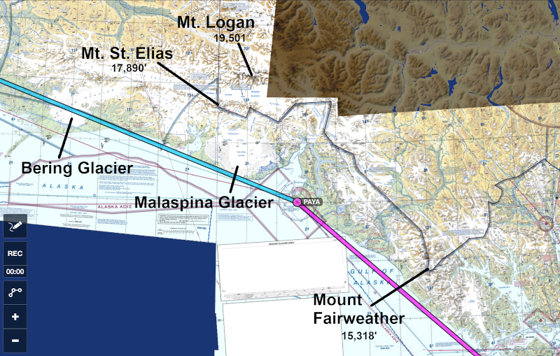
Zoomed in to show the location of a few significant mountains and glaciers
I checked out of the Cape Fox Lodge at 8:45 and was shuttled to catch the three minute ferry to the airport. The lodge is owned by an Alaska Native Corporation - in this case the Tlingit.
This is pronounced by the natives something close to: "Kleen-git" (no "T" sound).
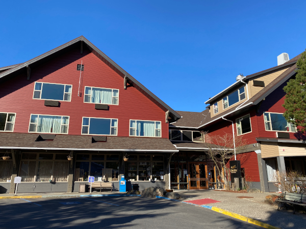
The Cape Fox Lodge in Ketchikan, AK
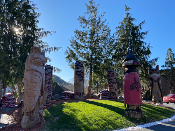
Totems at the entrance to the Cape Fox Lodge
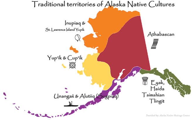
The Alaskan Native cultures
(from the The Alaska Native Heritage Center web site)
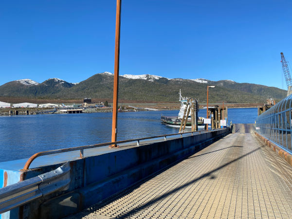
The ferry to the airport - Ketchikan, AK
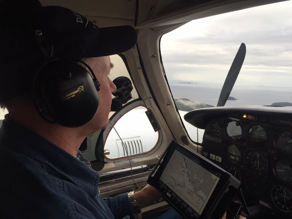
I packed the plane, put my survival vest on and strapped in for the 2 1/2 hour flight to Yakutat. Today's flight is over some very cold water, glaciers and rather inhospitable terrain, so I'd prepared the best I could and started up at 10:45.
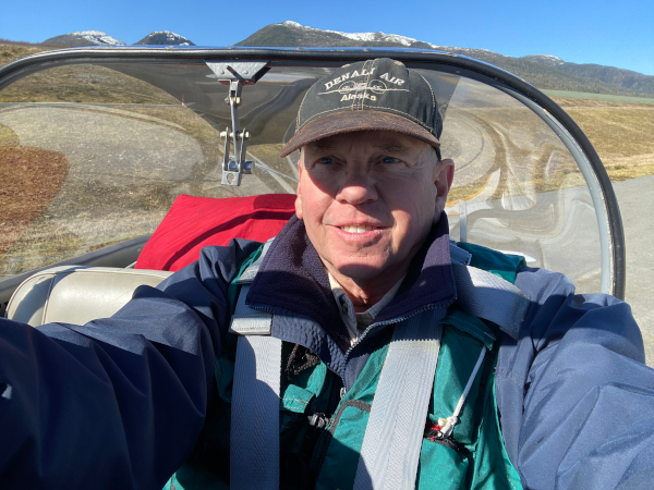
Survival vest on, strapped in for the 2 1/2 hour flight to Yakutat
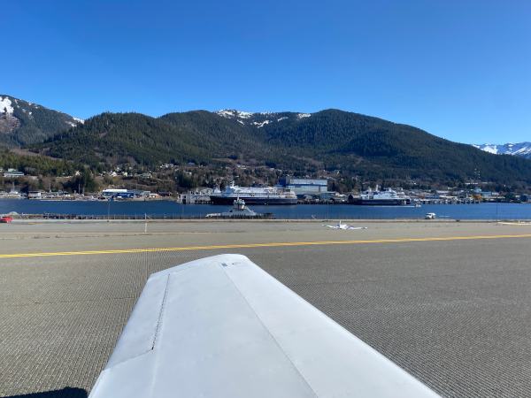
One last view of Ketchikan while taxiing out for takeoff
After an Alaska Airlines 737 departed I took off and climbed out to the northwest flying a direct course to Yakutat enjoying the tremendous view. The mountains to east make up the border with Canada and are about 70 miles away here.
I can't imagine the challenge Captain Cook had in 1778 being tasked with attempting to map all of the Pacific Northwest and Alaska as he searched for The Northwest Passage. If this interests you, check out the book "Captain Cook in Alaska and the North Pacific".
Climbing out from Ketchikan
The mountains 70 miles to the east form the border with Canada
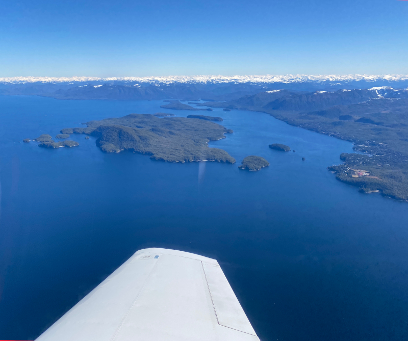
Over Kuiu Island about to fly over the Chatham Strait
You Tube video Click link or image to open YouTube
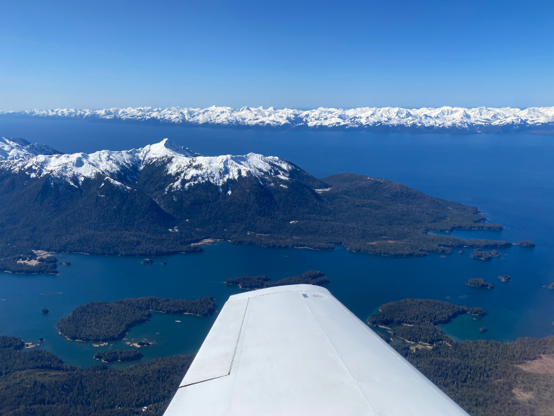
An hour after takeoff over Baranof Island 20 miles northeast of Sitka
Notice the volcano Mount Edgecumbe in the distance
Sitka is not visible between the near mountains and the volcano
Try to watch full screen and under the YouTube settings
select "Quality->2160p 4K" for the best quality
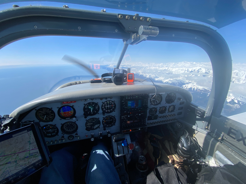
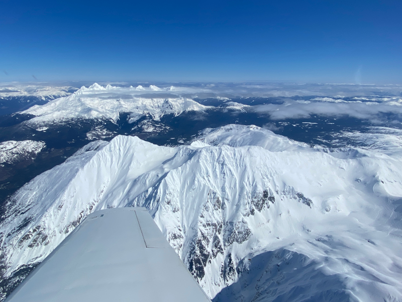
About an hour and fifty minutes after takeoff I passed Mt. Fairweather.
You Tube video Click link or image to open YouTube
Flying by Mt. Fairweather, Alaska (15,318') (left)
Left foreground is Fairweather Glacier.
Mt. Fairweather marks the narrowest spot along the Alaska panhandle,
being only 15 miles wide. Canada is immediately beyond.
Mt. Fairweather (left)
Two hours twenty minutes from Ketchikan I landed at Yakutat. The visibility was still excellent and I could clearly see Mt. St. Elias and Mt. Logan 70 miles away.
The fueling sevice is owned by a very cheerful husband and wife team - the Millers - who hand you a couple homemade chocolate chip cookies as you get out of the plane. Service couldn't be any better. I asked "How often do you have days like this here?"
'Teen' (short for Christina) said "A couple, but it's usually in January and the wind is blowing fiercely from the north, so this is very pleasant and very unusual." The temperature was 41°F and the wind was blowing only 7 K.
Knowing that this location being right on the Gulf of Alaska is subject to frequent bad weather and precipitation, I asked about the precipitation and she said "We get 200 inches of rain and 200 inches of snow each year."
I didn't know how to politely respond, but I think I just said: "Wow."
On final approach to the Yakutat airport
Mt. St. Elias is 70 miles ahead with Canada's Mt. Logan to the right
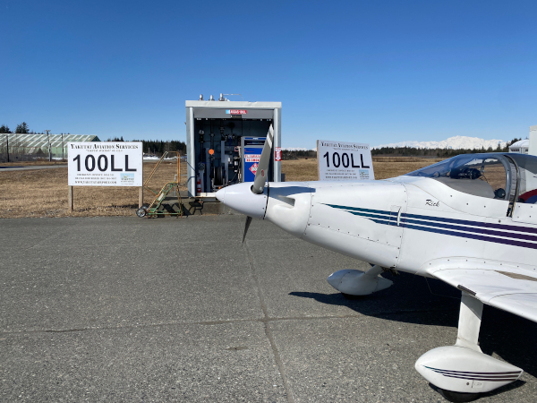
Refueling at Yakutat
Flight leg 8 - Yakutat, AK [PAYA] to Anchorage, AK [PANC]
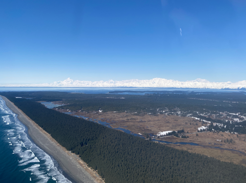
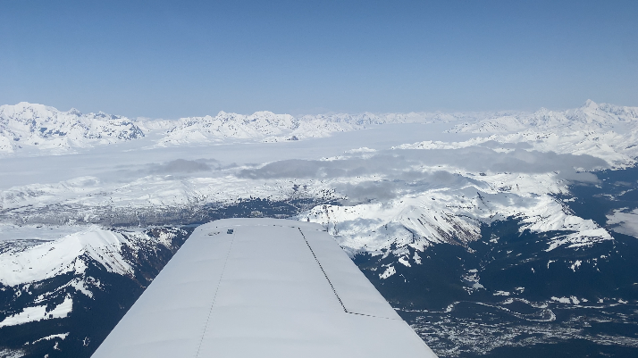
Departed Yakutat at 1351 for the 2 1/2 hour flight to Anchorage. Immediately after crossing Yakutat Bay I flew over the terminus of the Malaspina Glacier - which is approximately the size of Rhode Island.
Departing the Yakutat airport
Mt. St. Elias is 70 miles to the north with Canada's Mt. Logan to the right
The Malaspina Glacier - approximately the size of Rhode Island
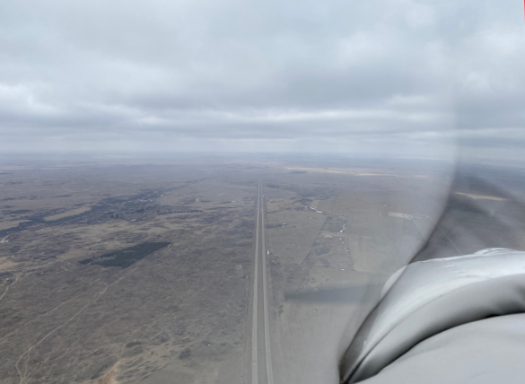
Continuing west I was slightly comforted [in the event of an engine emergency] that the direct route to Anchorage was right along the coastline which was a continuous stretch of completely uninhabited beach.
I had to wonder: "What would some property along here cost?"
Cockpit view while flying west along the coastline
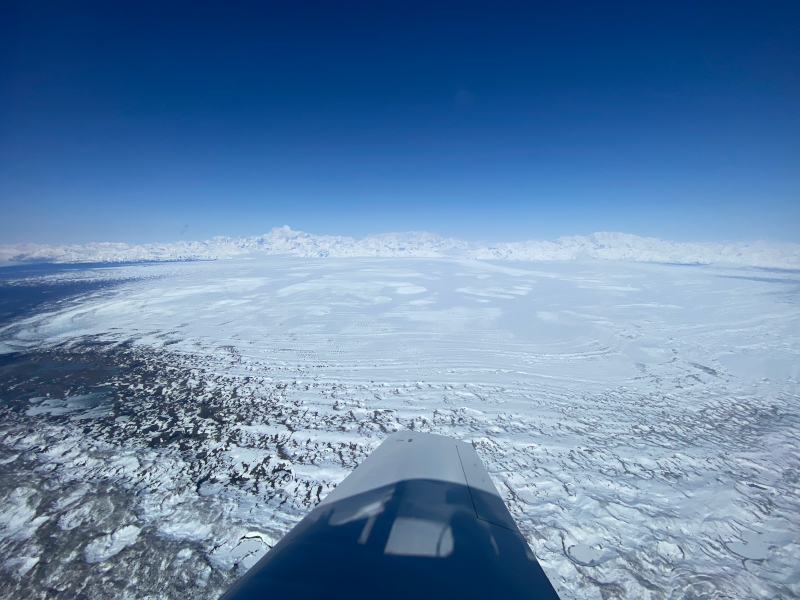
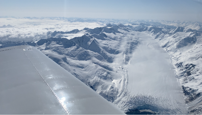
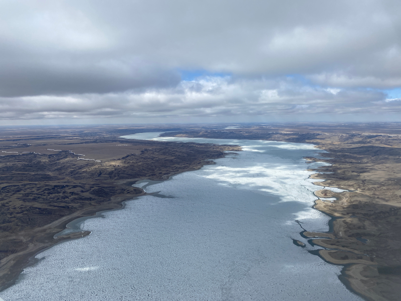
The next feature was crossing the immense Bering Glacier. Combined with the Bagley Ice Field this is the longest glacier in North America.
It starts at Mt. St. Elias about 100 miles to the east. The ice field actually continues into Canada where the name changes to the Columbus Glacier and Seward Glacier.
The terminus where I crossed it is about 30 miles wide - roughly the width of Baltimore County.
You Tube video Click link or image to open YouTube
Flying over the Bering Glacier.
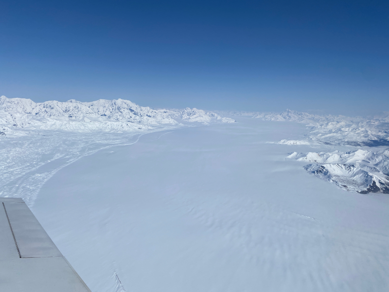
The immense Bering Glacier
Next was the Copper River basin where the world-famous Copper River salmon come from. This is just northeast of Cordova, Alaska.
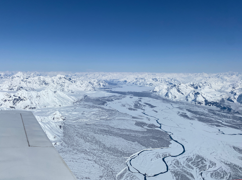
The Copper River - where the world-famous salmon come from
The beautiful Prince William Sound, Port Wells and College Fiord.
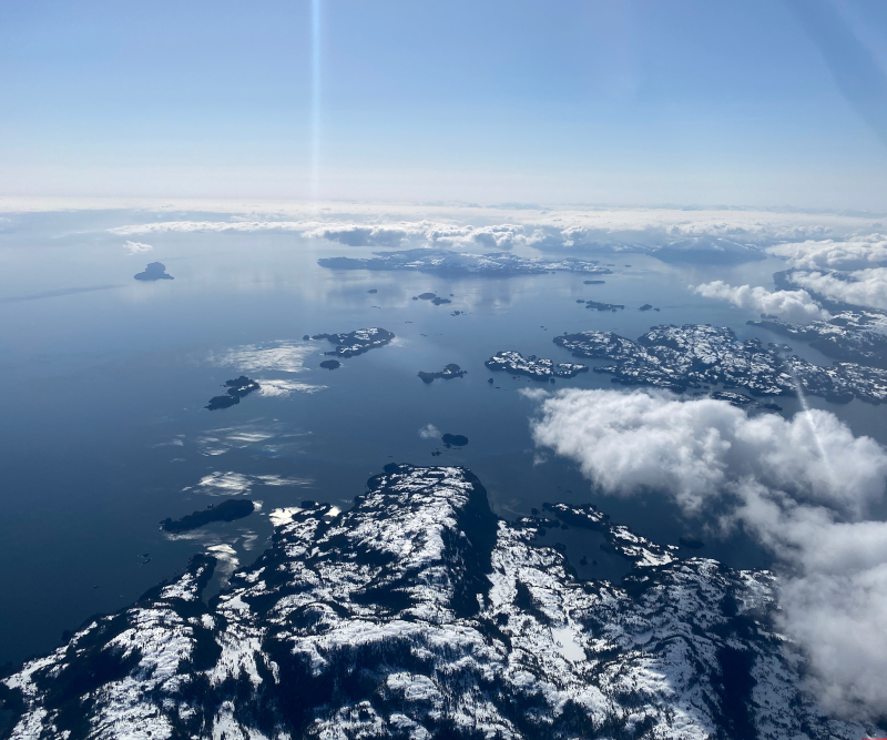
The west end of Prince William Sound.
If you take a cruise ship that terminates in Whittier, you sail through here.
Whittier is hidden by cloud on the far right side of this image.
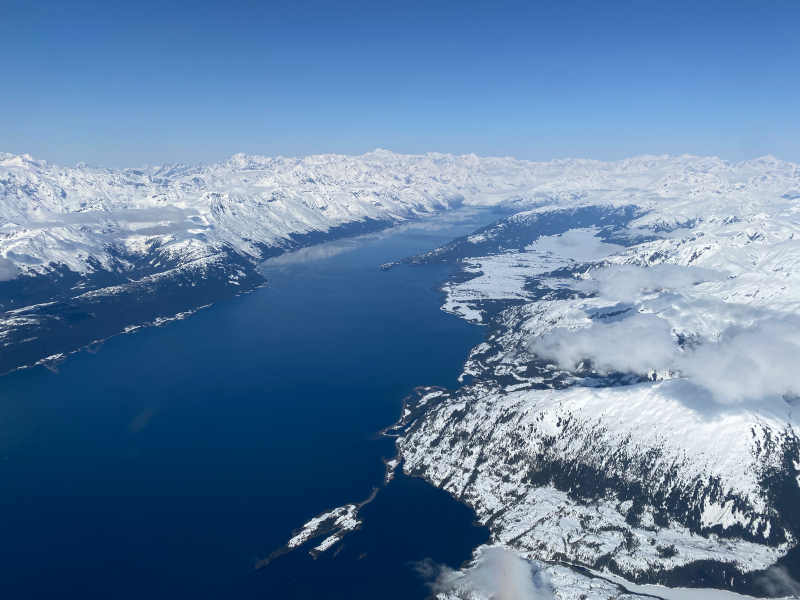
Port Wells and College Fiord.
The day-tour Philips 26 Glacier Cruise sails here
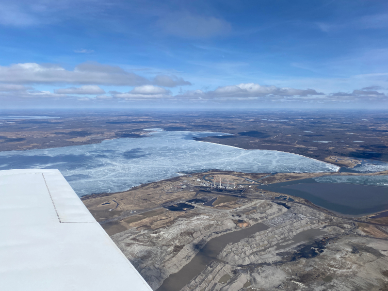
Just west of College Fiord is Harriman Glacier. This is about 9 miles long and in that distance goes from 5,000' to sea level.
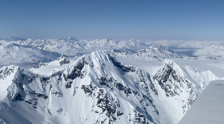
Then I crossed into the eastern edge of the Chugach State Park which is only 50 miles east of Anchorage. This is where I've taken many friends and family on local glacier flightseeing flights.
The glaciers include: Colony Glacier, Lake George Glacier, Knik Glacier then Whiteout Glacier and Eagle Glacier (plus others).
I started to get busy descending in Anchorage talking to ATC, so I couldn't take many more pictures.
You Tube video Click link or image to open YouTube
Flying over the Harriman Glacier
You Tube video Click link or image to open YouTube
The peaks in Chugach State Park
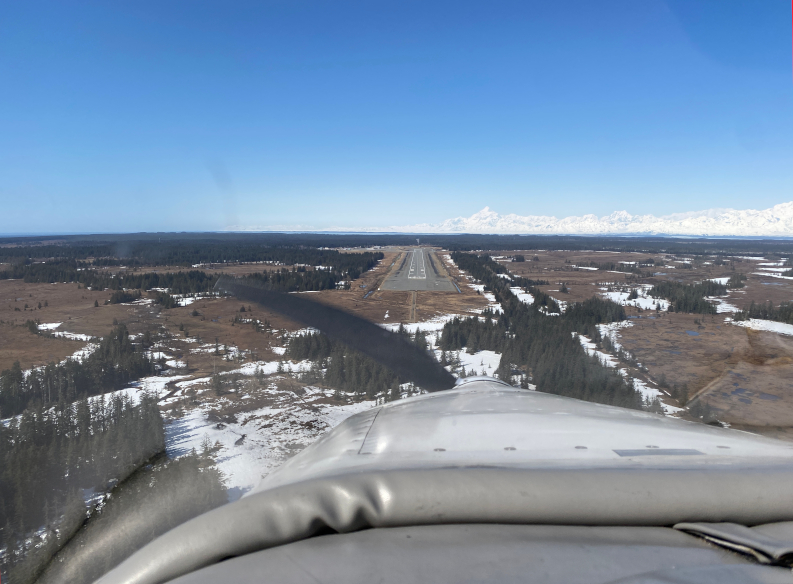
Arrival in Anchorage
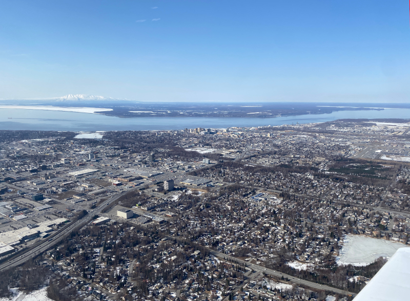
On the arrival into Anchorage
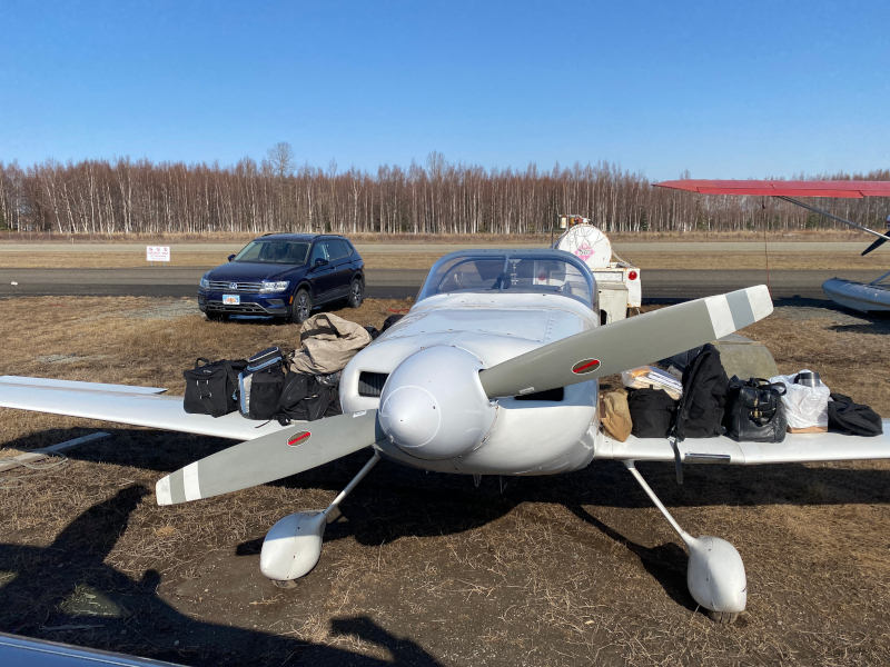
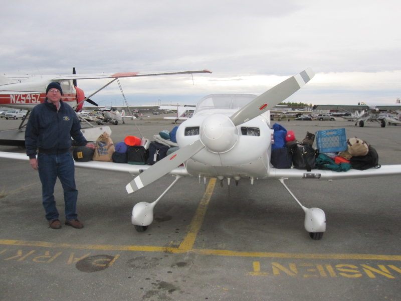
The baggage I carried
This doesn't include the survival gear which I left in the plane.
Tied down at Lake Hood
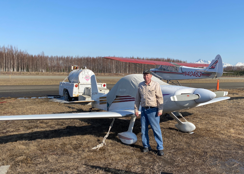
Total flying time for the trip was 20 1/2 hours. Here is the final itinerary with the final flight times.
Needless to say, it was a tremendously rewarding experience to fly the airplane I built on a trip like this.
I'd like to encourage those who are thinking about learning to fly to DO IT!
One of my favorite quotes is by Charles Lindbergh: "Science, freedom, beauty and adventure: what more could you ask of life? Aviation combined all the elements I loved."
I think he had it right.
-- END --
[Back to Top]
-- Wednesday, April 13, 2022 -- Day 4
Updated 4/13/22 at 2030 AKDT / 2330 CDT
The trip so far
Flight leg 6 - Grande Prairie, Alberta [CYQU] - Ketchikan, Alaska [PAKT]
Today was a good day. I was awake very early looking at the weather (and ice!) forecasts and was pleased with what I saw.
Departed the Happy Gas FBO [Fixed Base Operator] at 10 am. The temperature was -10°C / +14°F with a wind chill of -1°F.
But the airplane was a 'toasty' 59°F from being in the hangar, so it started right up. The fuel price was $2.50 CDN per litre which is $9.46/gallon CDN.
With the exchange rate, it worked out to $7.50/gallon in USD.
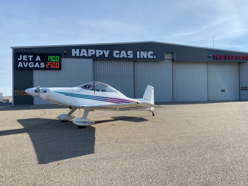
The Happy Gas FBO at Grande Prairie
I was concerned about icing on the climbout but it turned out that was not an issue. There was a thin layer at 8,000' which I climbed through in a minute on my way to 12,000' to cross the Canadian Rockies.
From there it was very clear, although cold at altitude being -17.4°C which is about 0°F.
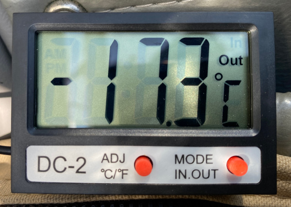
The Outside air temperature at 12,000'
Then just as I said to myself: "Whew, got it made now..." the autopilot roll mode went inoperative. (Don't ever say or even THINK "I've got it made""...) At least the altitude hold worked, but it required me to "do that pilot stuff" for the rest of the flight.
On the inReach I was communicating with the family and Tim suggested using a bungee cord to try and assist holding the stick centered. Rather mixed results with that, but it was a good idea. Thanks Tim!
The visibility was tremendous and after I passed Prince George, BC [CYXS] so I cancelled IFR, continued VFR at 10,500' and proceeded direct to Ketchikan [PAKT]. The scenery was stunning and I took about 100 photos.
But as you all know, I love snow-covered mountains, so I included a few photos below. On the Facebook page I also will post a short video of the view flying enroute. The shortcut saved a bunch of time and again via the inReach I asked Tim to call US Customs and update my
ETA from noon to 11:25 am. Customs does not like you to miss your estimates by more than 15 minutes. Tim said they were glad to hear the update.
The beautiful Canadian Rockies in British Columbia from 12,000'
The beautiful Canadian Rockies in British Columbia
The Seven Sisters Peaks in British Columbia
It was exciting to descend and cross into Alaska from a different direction - and the visibility was fantastic - especially for the Alaskan panhandle. The locals say they may only see 20 days per year like this. (It rains a LOT here.)
I landed at 1126 and US Customs came to the plane immediately after I called on my cell phone from the plane. They were very friendly and somewhat interested in the Mustang II.
As I was chatting with him it occurred to me that I'd crossed completely over the Pacific Time Zone, this being the first time I've ever flown two time zones away in a light airplane.
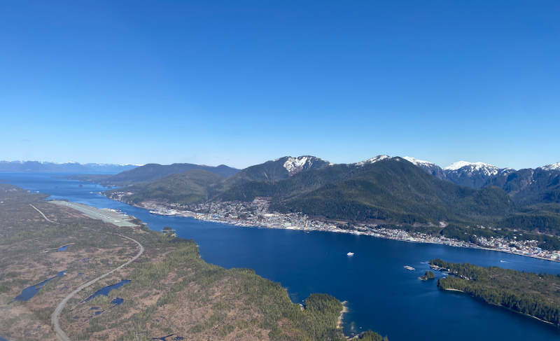
The Ketchikan airport and town across the channel
I tied the plane down for the night, caught the ferry to town and got a ride to the Cape Fox Lodge which I think is quite nice. The view from the room was of the water and the mountains across the channel - but then again, in Ketchikan I guess almost everyone has a good view like this.
I enjoyed an excellent panko-crusted halibut and then sat down to update this blog.
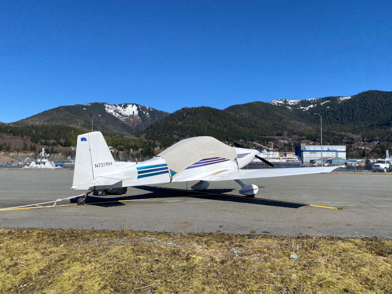
Secured for the night at Ketchikan
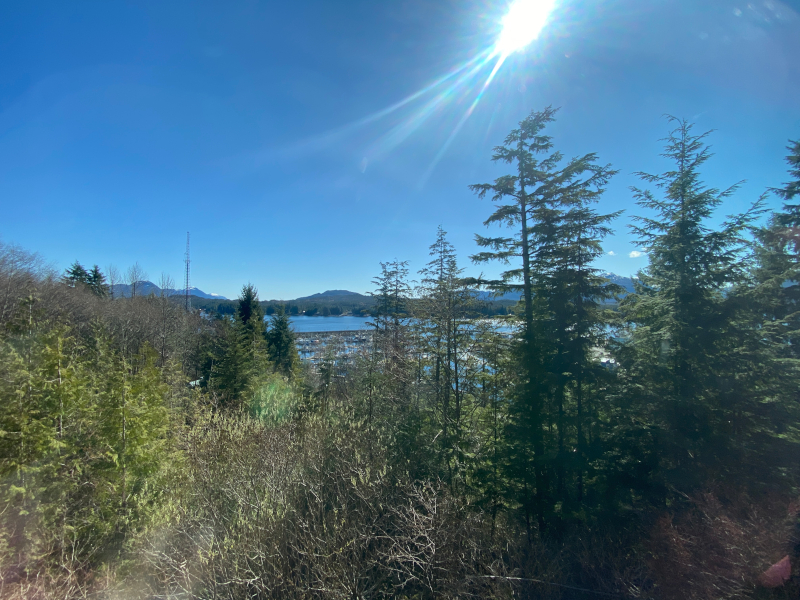
View from my hotel room in Ketchikan
Tomorrow's plan is to fly to Yakutat [PAYA] and then on to Anchorage [PANC] with a total flying time of 4+40. For the first time on the trip, there is no weather to be concerned about. (But I'm NOT going to say the 'forbidden phrase...'.)
It'll feel good to get home.
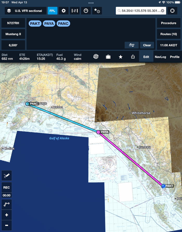
Tomorrow's planned route
[Back to Top] [To next day - Day 5]
-- Tuesday, April 12, 2022 -- Day 3
Updated 4/12/22 at 1925 CDT
As I sit on the ground in Grande Prairie today, below is an update including Day 2 below and a revised Itinerary / Plan.
I talked with the NavCanada FIC again and the weather looks better, although not excellent for a flight from Grande Prairie to Ketchikan tomorrow. 'Stay tuned...'
Plan for Day 4 - Wednesday
Grande Prairie to Ketchikan, Alaska
The 'zigs' on the route are for an IFR routing across the Canadian Rockies
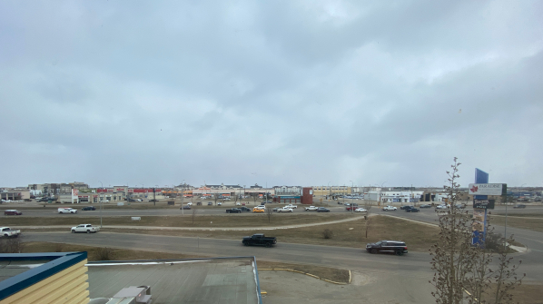
The view from the hotel in Grande Prairie for a day and a half
If you ever drove to Alaska you probably drove by here on Route 43 just outside my window.
This doesn't officially become the Alaska Highway or the ALCAN until Dawson Creek 80 miles west of here.
So, I have 80 miles to go to get to "Mile 0" of the Alaska Highway...
Updated 4/12/22 at 1240 CDT
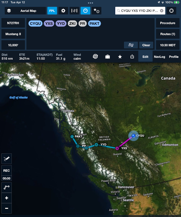
I am delaying an extra day in Grande Prairie, Alberta [CYQU] with a tentative departure from here later Wednesday morning.
[Back to Top] [To next day - Day 4]
-- Monday, April 11, 2022 -- Day 2
Updated 4/12/22 at 1900 CDT
The trip so far
Updated 4/12/22 at 1830 CDT
Flight leg 3 - Minot, ND [KMOT] to Regina, SK [CYQR]
Today I departed Minot, ND in clear, cold weather for Regina. It was 28°F, -2°C with a 13 K wind. This is about as cold as I'd want to start my precious engine without engine pre-heat because an aircraft engine can suffer some internal damage from metal-to-metal scuffing until the oil starts to flow adequately.
Part of my route change rationale is that it was going to be considerably colder in northern BC and the Yukon and I couldn't positively establish an arrangement for engine pre-heat along that route after an overnight.
Thus, I chose to stop in Grande Prairie - where I was able to secure a heated hangar for the overnight(s) eliminating the concern about the cold engine start. I included a photo of a fellow pilot from ND that was getting his engine and cockpit pre-heated. (That would've been nice...)
Aircraft and engine preheating at Minot. (Not my plane)
I took off from Minot at 0849 and captured a photo as I crossed out of North Dakota into Saskatchewan which has a clearly-visible line when viewed from above. I guess my fourth grade teacher was wrong when she said such lines are only on maps, not the real earth... :-)
The US - Canadian border. The US is on the left and Canada is on the right
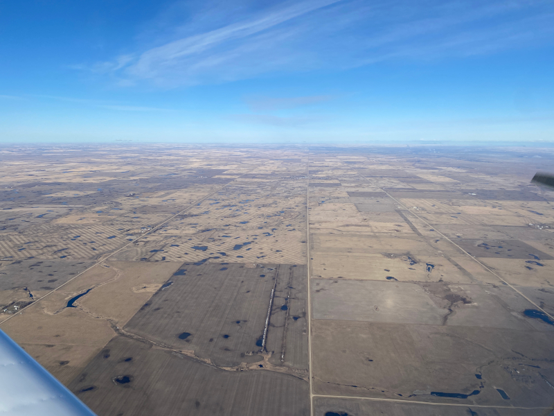
Briefly some puffy cumulus developed below, (photo below) but they quickly built up. I requested a climb from 6,000' to 8,000' from Winnipeg [Air Route Traffic Control] Center which put me on top of the ice. Until it built up some more... I told Winnipeg that I was collecting ice and they offerred me a 'block altitude 8-9,000' which worked out well.
I leveled at 8,500' keeping me just above the icy tops.
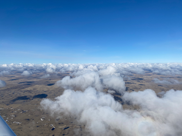
Fair weather cumulus shortly after entering Canada
Interestingly, along this part of the route I was in "Uncontrolled" airspace in Canada (the green area) and for a while after crossing the border out of radio communication as well. The first time I'd experienced this 20 years ago was at dusk and it was an eerie feeling being over a foreign country after sunset not talking to anyone. (photo below)
Uncontrolled airspace in Canada
It was quite blustery at Regina with winds at 16 gusting to 24 K. I descended fairly rapidly through the icy clouds and flew the RNAV GPS approach to runway 30 at Regina, landing an hour and a half after takeoff at 0919 CST (UTC-6 - they don't observe DST).
On the approach into Regina.
The procedure is to remain in your plane until contacting Customs via cell phone and usually they answer within a minute or so. Today it was 30 minutes until they did (roaming cell charges apply at $1 or $2/minute...).
Mike at the Kreos FBO [Fixed Base Operator] approached the plane while I waited. He put some chocks under my wheels and then positioned the fuel truck right in front of me since the plane was noticeably rocking in the wind!
He said "I bet you didn't bargain for this!" [wind]. I talked to Customs, gave them my information and ArriveCAN number (relating to COVID vaccination status) and they issued me a clearance number saying I was "cleared". Nice.
Flight leg 4 - Regina, SK [CYQR][ to Wetaskiwin, AB [CEX3]
After fueling at the Regina FBO I spent some time talking with a NavCanada Flight Information Centre specialist, who was extremely helpful. I always compliment these folks at the great job they do.
I explained my situation and as he studied the satellite imagery and other data he offered the suggestion to fly VFR [Visual Flight Rules] below the clouds due west along the Trans-Canada Highway as far as Swift Current then turn slightly northwest bound to land at Red Deer.
He expected that would be a good route to avoid the reduced visibility due to snow showers, but warned that it would be turbulent.
I did exactly that, departing Regina at 1102 and flew just 2,000' AGL [above ground level], heading west generally along the Highway, and as promised it was fairly bumpy.
Flying VFR westbound along the Trans-Canada-Highway
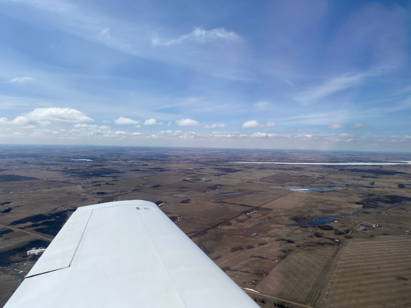
Visibility was very good but the moderate turbulence continued as I started nothwestward toward Red Deer. The weather continued to improve.
I got an update that Edmonton and Wetaskiwin were fairly clear, but windy with winds 18 K gusting to 24 K.
Crossing the Saskatchewan River as the weather started to improve.
(View to the north off the right wing)
It cleared up very nicely approaching Edmonton and Wetaskiwin.
I changed the destination from Red Deer back to Wetaskiwin and landed there at 1350, 2+47 after takeoff and fueled up there.
The weather cleared up nicely as I approached Edmonton and Wetaskiwin
Flight leg 5 - Wetaskiwin, AB [CEX3] to Grande Prairie, AB [CYQU]
Planning ahead and trying to get to Grande Prairie I was disappointed to see it was IFR [Instrument Flight Rules] due to snow showers. East of Grand Prairie is Whitecourt which was good VFR, so I took off VFR and headed west at 1450.
Clouds started forming again west of Edmonton, but the visibility was good for a while.
Lake Wabamun west of Edmonton
Passing Whitecourt the visibility had improved so I continued the extra 128 NM to Grande Prairie. I included an image of the view on the iPad.
It was very turbulent and cold for the entire flight with snow showers appearing as I approached Grande Prairie.
The winds were out of the north at 13 gusting to 19 K, but I was pleasantly surprised it was not turbulent during the landing on runway 30 at 1628 as it began to snow again.
The temperature was -5°C / 23°F and with the wind, there was a 'bit of a nip' in the air...
Snow showers and turbulence approaching Grande Prairie
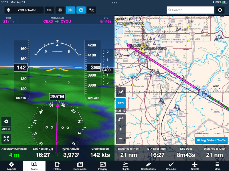
A view of the iPad on ForeFlight approaching Grande Prairie
The FBO there has the interesting name: "Happy Gas" and I was happy to see the lineman motion me to park in front of their huge, beautiful hangar where we stored the plane.
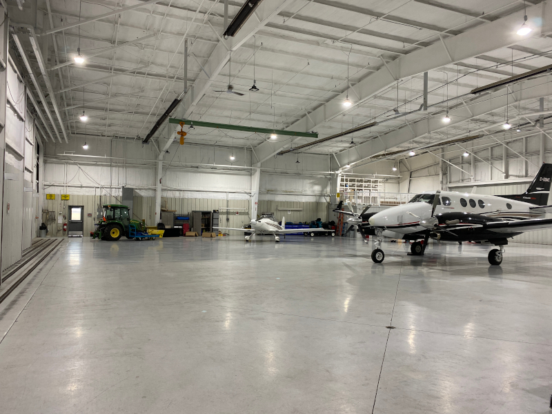
The huge hangar at the "Happy Gas" FBO in Grande Prairie
It is a great relief to have the airplane kept warm and out of the snow here
I had a nice steak dinner at the "Paradise Inn" and after writing yesterday's short Facebook post then fell into bed. I'd have to say, in my 50 years and 23,000 hours of flying, today was probably the most intense combination of turbulence and duration that I've experienced.
A quick review of the weather forecast showed that tomorrow (Tuesday) was going to be overcast with snow was almost a relief. I could use the extra day of rest.
[Back to Top] [To next day - Day 3]
-- Sunday, April 10, 2022 -- Day 1
Updated 4/10/22 at 2000 CDT
Flight legs 1 and 2 - Olive Branch, MS [KOLV to Omaha, NE [KOMA] to Minot, ND KMOT
As I suspected, after a long day of flying I really need to rest, so this report will be fairly short.
Linda, Tim & Matt got up early to see me off - for which I was grateful.
The flight was clear and smooth for the most part enroute from Olive Branch, MS to Omaha, NE.
About to depart
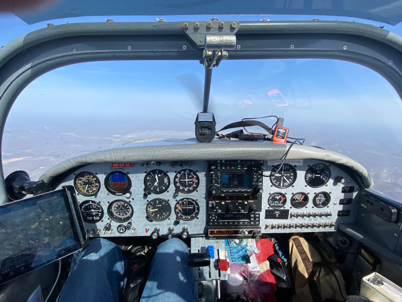
Inflight view
The second leg was about as expected, maybe slightly more difficult because I did start to encounter ice over South Dakota. I tried several different altitudes but had to descend into
pretty rough air to be below the ice. It was about 2 hours of moderate turbulence, which nobody likes.
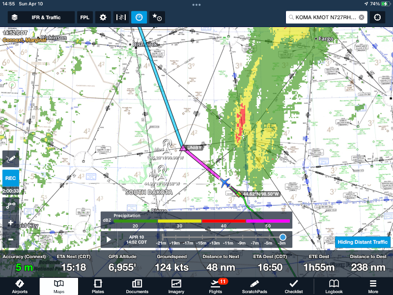
Deviating around the weather - which contained ice
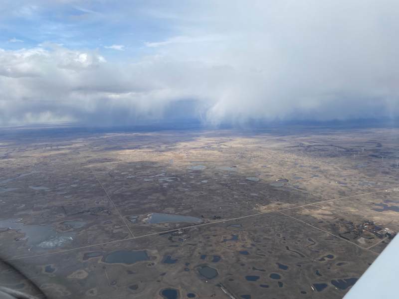
Under the could bases it was quite turbulent in and out of these snow showers.
Total times for today were: 6+46 flight and 7+17 block (which includes taxi time).
Tomorrow's plan is to clear Canadian Customs in Regina, Saskatchewan (CYQR) and then fly to Wetaskiwin, Alberta (CEX3) and then Grand Prairie, AB (CYQU) where I have reserved a heated hangar. It is expected to be 12°F there Tuesday morning.
I am changing the rest of the route to probably fly across central British Columbia and clear US Customs at Ketchikan on Tuesday instead of flying my usual inland route further north.
The frigid temperatures are discouraging me from that route this time.
I'll plan to try and provide an update tomorrow (Monday evening) from Grand Prairie.
My plan for Day 2 - Monday
[Back to Top] [To next day - Day 2]
-- Saturday, April 9, 2022 --
Updated 4/9/22 at 1450 CDT
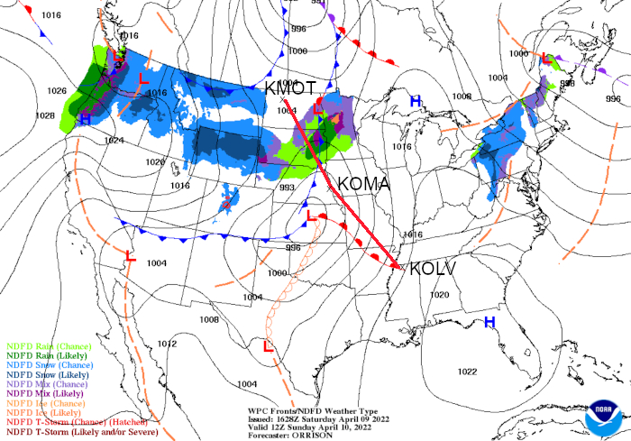
The route for Day 1 tomorrow from Olive Branch, MS [KOLV] to Omaha, NE [KOMA] to Minot, ND [KMOT] has a few challenges: As you can see, a low pressure area will be in the middle of the route with headwinds, turbulence and for part of it over South Dakota - forecast ice.
Not good.
The low will actually be a bit further east than in this image which is effective at 7 am CDT (12Z) with my planned takeoff time being 8:40 am, so I might actually fly through the center of it. Pretty strong crosswinds on the first leg enroute to Omaha and I'll have to evaluate the second leg once in Omaha.
I'm hoping / expecting there might be a bit of a gap in the weather over South Dakota, but if not, I might be enjoying a good Omaha steak there tomorrow night.
By the way, I normally don't use the word "hope" in my flying, but here it's used in the context that I have several good alternatives available (including turning around or waiting on the ground as long as I need to).
In flight, 'hoping' and 'pressing on', is to me of course not at all acceptable.
You might wonder why the route on the first leg has several bends in it while the second leg doesn't. There are several Restricted Areas in Missouri plus the Kansas City Terminal Area which I have planned to fly around, but ATC might clear me more direct if they are not active or busy on Sunday morning.
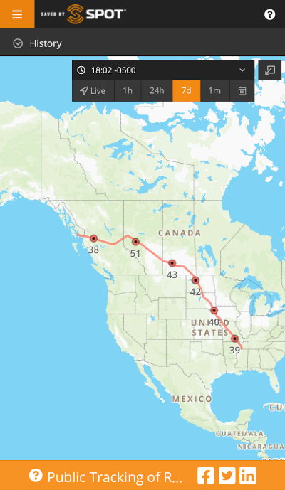
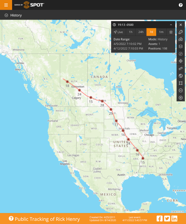
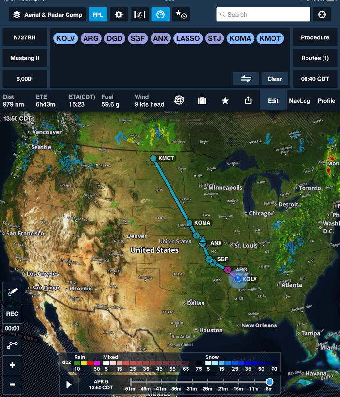
Flight plans have been filed and can be pre-viewed on Flight Aware at: https://flightaware.com/live/flight/N727RH. The link to this is on my Tracking page linked above on this page or found here:
http://experimentalairplane.com/tracking.html. I plan to have both my
inReach and SPOT tracking devices active when flying, so be sure to "tune in" to watch them tomorrow.
I probably won't be posting any more on this page until after arriving wherever I wind up tomorrow night. 'Hopefully' Minot.
 [Back to Top] [To next day - Day 1]
-- Friday, April 8, 2022 --
Updated 4/8/22 at 2215 CDT
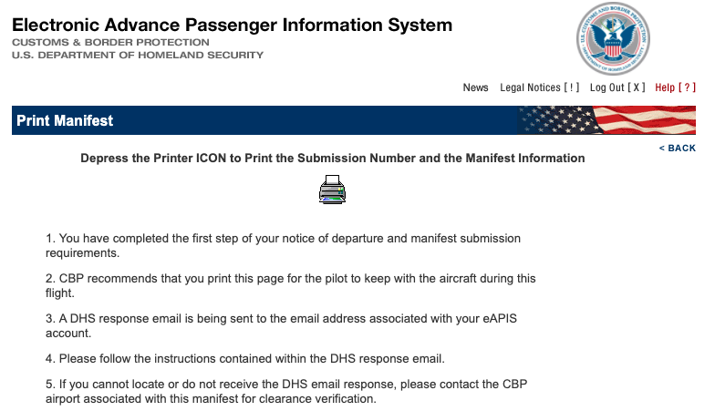
Tonight I completed the necessary permissions online to depart and enter the US using the Department of Homeland Security's eAPIS website. [electronic Advanced Passenger Information System].
Here's the URL for it: https://eapis.cbp.dhs.gov/. Flying a light plane, we must literally get permission to depart the US and file another for the arrival.
In my case, on Monday I'll be departing Minot, ND and landing in Regina, SK. Then on Wednesday I plan to depart Whitehorse, YT and land in Northway, AK. I'm not displaying examples here because I'd have to redact most of it, but you get an email repeating all the crew (and passengers, if any) information saying you are "...cleared for this flight".
In addition to this notification I'll need to call US Customs at least 2 hours prior to my ETA to confirm my planned arrival.
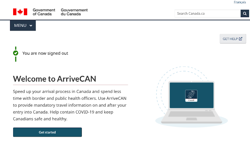
For the Canadian requirements, I'd previously filed my vaccination information on an app called ArriveCAN (or you can online here: https://arrivecan.cbsa-asfc.cloud-nuage.canada.ca/).
Tonight online I advised of my arrival and received a receipt with a QR code.
Additionally, I'll also need to call CANPASS (888) 226-7277 https://www.cbsa-asfc.gc.ca/prog/canpass/privateair-eng.html at least 2 hours in advance of my ETA in Regina. These requirements are in addition to filing the required ICAO [International Civil Aviation Organization] flight plans for any International flights.
I've printed paper copies of the Customs approvals. The "paperwork" is now done up to filing the flight plans and making the Customs notification phone calls. Upon arrival in Canada (pre-COVID) in most cases I simply called CANPASS on my cell phone from the plane and received a verbal clearance with a clearance number from them. Very nice.
Updated 4/8/22 at 1645 CT
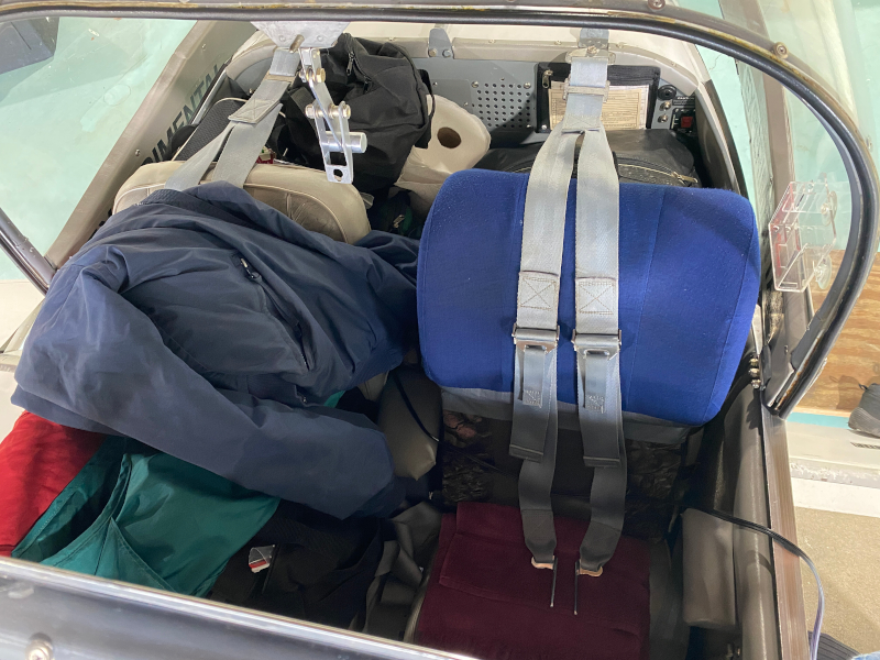
Today I loaded the plane to make sure it all fits. It does, and there's even a little room left for me!
Updated 4/8/22 at 1345 CT
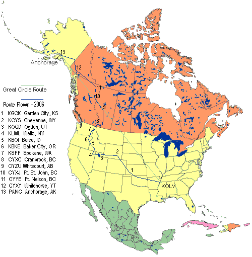
Planned departure is still Sunday morning. Here is a recap of the previous flights to Alaska:
I first made a lightplane flight north from the Memphis area to Anchorage 20 years ago - in 2002.
The links on the following pages have a lot of photos, and some journal entries. The images below on this page are just a few samples.
The airplane stayed in Alaska from 2006 until 2008.
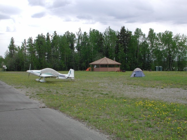
1) 2002 flight - Mustang II Camped on the airports at Ft. St. John, BC and Whitehorse, YT
Ft. St. John, BC
Whitehorse, YT
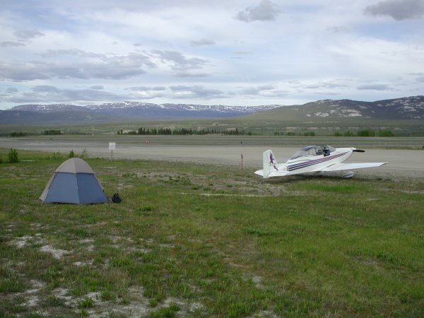
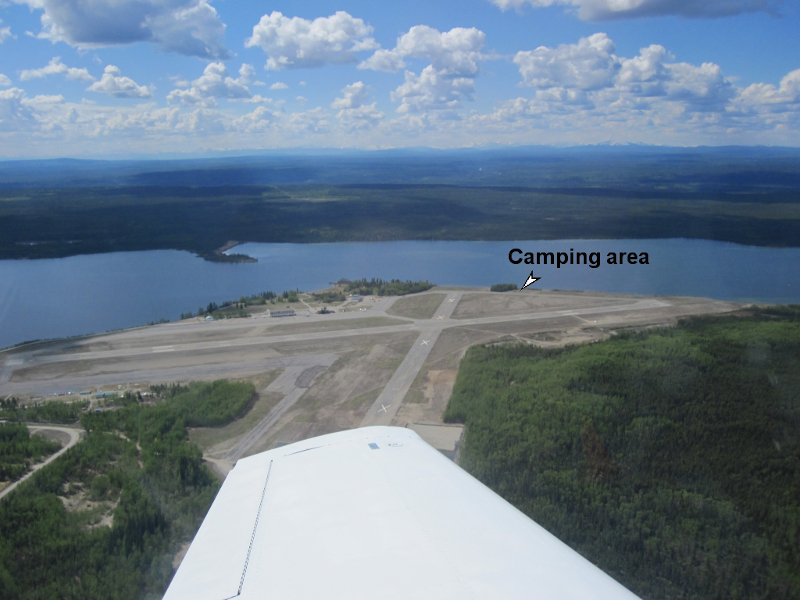
2) 2005 flight - Mustang II Camped on the airport at Watson Lake, Yukon
3) 2006 flight - Mustang II Landed in several "new" western states bringing total to 49 states in my plane.
(No, I'm not ever flying it to Hawaii.)
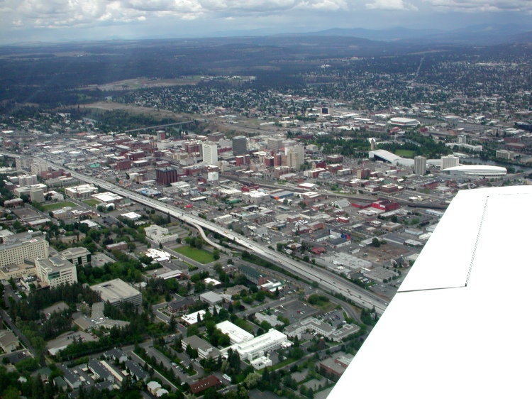
Spokane, Washington - the 49th state to land my experimental Mustang II
4) 2010 flight - Mustang II Camped again at Watson Lake, YT
Virga over the Yukon Territory
5) 2011 flight - Mustang II I flew from Daytona Beach to Anchorage in a record three days.
I had amazing tailwinds northwest bound on this trip enabling a lot of miles in three days.
Daytona Beach on Monday...
The Whitehorse, YT Airport on Wednesday
In Anchorage Wednesday May 18, 2011. This all fits in the Mustang II!
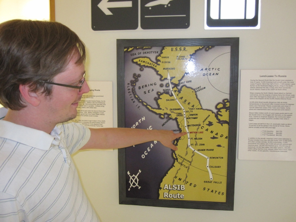
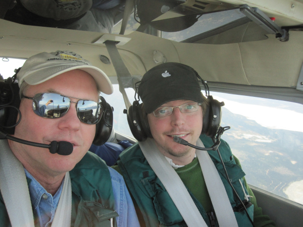
6) 2012: my son Tim flew left seat, PIC [Pilot In Command] to Alaska with me for 26 hours over four days in our Cessna 182.
Tim showing our position at Watson Lake, Yukon.
This was a strategic route in World War II where the US send thousands of aircraft to the Russians to fight the Germans.
Flying low over the Yukon
Wearing our survival vests over the western Yukon
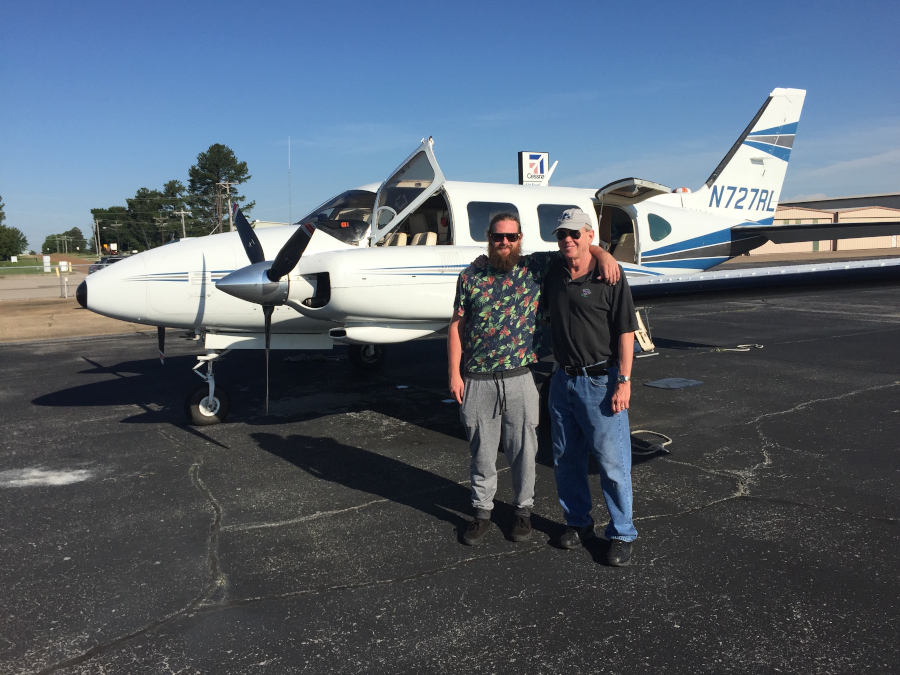
7) 2016: First flight in the Navajo to Alaska with Karl Zeiset.
8) 2017: Flew the Navajo to Alaska with my son Matt.
9) 2018: Flew the Navajo to Alaska with Ken & Brenda Hammerton.
10) 2019: Flew the Navajo to Alaska solo.
[Back to Top] [To next day - Saturday April 9th]
-- Thursday, April 7, 2022 --
Updated 4/7/22 at 1830 CT
Detailed plan of dates and times
Here is a pdf of my detailed plan of flight times, ETAs [Estimated Times of Arrival], etc.
The Itinerary (version 2.0)
After flying on a tight schedule for over 33 years, it might seem unnecessary to make one for myself in retirement, but I guess it's a bit of a habit and challenge.
There actually is a practical use to make a plan like this to estimate arrival times for Customs, filing flight plans, etc. The time zones can be a bit challenging in Canada with a few provinces not observing DST and sections of eastern BC in the Pacific Time Zone, but using Mountain Time but not observing DST! (What?!?)
So, I'm just referring to them in relation to UTC such as UTC-7. More than once folks have goofed up their flight plans or confused ETAs for Customs due to the local time conversions.
Of course weather or maintenance issues can completely change these plans, but we'll see.
Updated 4/7/22 at 1600 CT
Previous considerations and planning
I'll share some other thoughts that are behind this year's decision to fly the Mustang II north for the summer.
The last two years (2020 and 2021) the Canadians have generally not permitted pleasure flights through due to COVID concerns.
Earlier this year, flights were permitted again with a recent COVID test and as of April 1st they removed the test requirement which of course will make things a lot easier.
This enabled the "inland route" which I clearly prefer in the single-engine.
Previous emergency on the coastal route
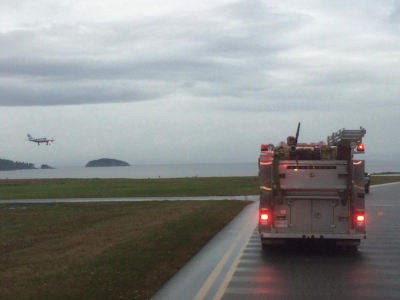
I'd flown the coastal route southbound a few times in the Piper Navajo, but in September, 2016 I did have an engine failure in it at about the 'worst spot'.
Matt was flying with me and we were over the wilderness of British Columbia half-way from Ketchikan to Bellingham at 11,000' in instrument conditions [in the clouds] avoiding some thunderstorms and ice at the same time.
The left engine's turbocharger bearing had failed causing its destruction and dumping all of the oil overboard, necessitating the engine shutdown. All the oil went out the bottom and it was not visible from the cockpit - my only indication was a slowly 'dying' turbo (dropping manifold pressure) until it quit.
Of course I quickly feathered it and thankfully there was no internal engine damage. Matt was sitting in the back working on some video editing when it happened and I'd love to have a photo of his face when it did. I motioned him to come up to the copilot seat and assist me / back me up as I completed the emergency checklist.
The Navajo performed beautifully on one engine - it has a 15,500' single-engine service ceiling - and I declared an emergency with Vancouver Center who suggested going to Port Hardy which was the nearest airport about 90 miles away on the northwest tip of Vancouver Island.
We were in cloud during the divert and flew to a spot on the DME arc for the ILS [Instrument Landing System] for Runway 13. This was in a non-radar environment. The weather was about 1,400' broken and 4 miles visibility in light rain.
I'd have to say, I think it all went 'textbook', flew the approach there on one engine and landed without incident.
The emergency equipment - fire trucks, etc. were waiting for me as well as an assortment of government officials. I spent a little while talking with Canadian Customs (we had not planned to land in Canada!) as well as the DOT and equivalent of the FAA explaining what happened.
If you use Facebook, you can see a few of my posts and photos about the event here
Sooooo.... I'm glad to be flying the inland route in my homebuilt single-engine experimental airplane.
(Click on thumbnails for larger images)
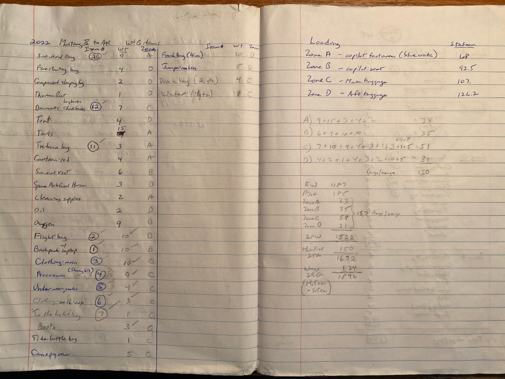
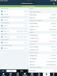
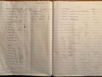
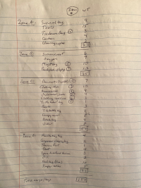
I also just added a couple photos of my "Weight & Balance notes" to the bottom of yesterday's entry showing a bit more detail about all the items I'm carrying.
As you can see a lot was done in pencil to move things around and make it work. Thank goodness for ForeFlight's Weight & Balance feature! The "Item numbers" are put on tags for the various black bags to keep straight what is in each one. The Mustang II's confined baggage storage requires lots of 'small, squishy' bags.
[Back to Top] [To next day - Friday April 8th]
-- Wednesday, April 6, 2022 --
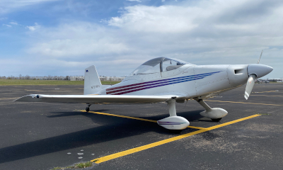
I'm starting a blog for this year's flight to Alaska in the Mustang II. We'll have to see if it is at all practical for me to update this once underway while enroute, but I'll give it a try.
A lot of planning and preparation has already taken place including deciding which route to take.
Route options
In general, flying a light plane from the Memphis area to Alaska offers two options:
The first what I call "The inland route" following The Alaska Highway from Dawson Creek, BC northwestward, entering Alaska at Northway, which is how I've flown the first ten trips northbound and is fairly close to The Great Circle Route.
The second option is "The Coastal Route" departing the US at Bellingham, WA and landing in Ketchikan, AK. This has the distinct advantage of avoiding dealing with Customs, either the US or Canada.
The significant disadvantages are that 1) the weather frequently is worse and 2) in a single-engine airplane the forced landing options are not very good - it consists of a lot of rough coastline or cold water.
Two days ago the extended forecasts (which I looked at using WeatherUnderground) called for a lot of rain and poorer weather along the coastal route.
The Alaska Highway looks considerably better at this point although I will be preparing for colder temperatures. I've already called ahead to Ft. St. John (CYXJ) and Whitehorse (CYXY) and confirmed that engine pre-heat will be available for my probable overnights there.
At the moment I'm planning to depart Sunday, April 10th and take four days on this trip with overnights at Minot (KMOT), Ft. St. John (CYXJ) and Whitehorse (CYXY). Flight time in the Mustang II is about 20 hours to Anchorage.
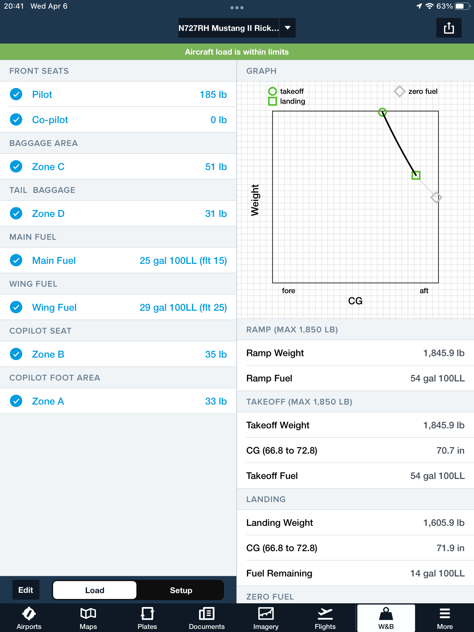
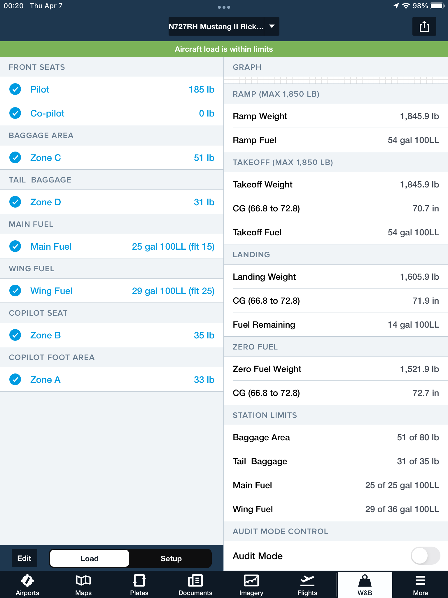
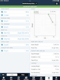
Weight & Balance
The other day I already loaded the plane with my survival gear and everything except clothing bags to check for fit and to run a trial Weight & Balance.
It turns out my Zero Fuel Weight CG is bumping the aft limit, so trying to put a few heavier items a bit more forward has helped. As far as gross weight, if I limit my wing tank fuel to 29 gallons instead of the 36 gallon full load, I'll be under the max gross weight of 1,850 lbs.
This will provide 54 gallons of fuel, which at 8.5 GPH is 6 hours, 20 minutes of fuel.
See my W&B as calculated on ForeFlight. (Click on thumbnails for larger images)
[Back to Top] [To next day - Thursday April 7th]
|