|

|
|

|
| Flight North to Alaska | |||||
 Gear to Load Fits, and within CG (104 KB) |
 IFR on top * 6,000' over Arkansas (43 KB) |
 North Omaha Very convenient gas station (103 KB) |
 North Omaha * Good fuel price (110 KB) |
 Enroute * over South Dakota (54 KB) |
 Minot, ND Called CANPASS (77 KB) |
 Regina Final for runway 31 (65 KB) |
 Edmonton City Centre airport left base for runway 16 (106 KB) |
 Dawson Creek British Columbia The beginning of the Alaska Highway (70 KB) |
 Ft. St. John British Columbia (81 KB) |
 "Sparsely Settled Area" Northeastern British Columbia (70 KB) |
 Ft. Nelson British Columbia left base for runway 25 (81 KB) |
 Towering Cumulus over the Alaska Highway south of the airway (46 KB) |
 Watson Lake, YT Final to runway 26 (57 KB) |
 Watson Lake, YT Excellent camping (95 KB) |
 Whitehorse Yukon Territory from 10,000' (112 KB) |
 Kluane Lake Yukon Territory (63 KB) |
 Northway, Alaska Cleared US Customs (109 KB) |
 J-3 Amphibian Northway, Alaska (93 KB) |
 Northway to Anchorage at 16,000' (76 KB) |
 Merrill Field Anchorage, Alaska approaching from Ship Creek (82 KB) |
 View from Ace Hangars room Merrill Field Anchorage, Alaska (Ground photo) (63 KB) |
||
| Summer in Alaska | |||||
 Harding Icefield Several hundred square miles (87 KB) |
 Harding Icefield (2) On Kenai peninsula between Seward and Homer (98 KB) |
 Homer Final to runway 21 (41 KB) |
 Seldovia 1,800' gravel strip in center of photo (90 KB) |
 Bald Eagle (55 KB) |
 Bald Eagle feeding Seldovia (120 KB) |
 Mt. Spurr 80 miles west of Anchorage (55 KB) |
 Glaciers south of Denali (114 KB) |
 Denali Mt. McKinley Highest point in North America (123 KB) |
 West Fork Ruth Glacier next to Denali / Mt. McKinley (152 KB) |
 10:30 PM in Anchorage another hour until sunset (60 KB) |
 11:25 PM view northwest Mt. McKinley / Denali 130 miles away (63 KB) |
 Summer Solstice sunset Longest day: June 20th sunset at 11:42 PM Looking NNW (81 KB) |
 Moose frequently seen near the Anchorage airport (117 KB) |
||||
| Flight Southbound from Alaska | |||||
 About to depart Anchorage August 15th (67 KB) |
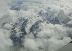
 Tops of the Chugach Mountains Two Minutes after takeoff City of Anchorage below the clouds (35 KB) |
 Smokey conditions Twenty minutes north- east of Anchorage Visibility continued to worsen (27 KB) |
 Whitehorse, YT approach plate Flew the DME arc transition from the west (133 KB) |
 Partial panel approach Going visual on final at Whitehorse after vacuum pump failure (120 KB) |
 Terrain along the Alaska Highway. (highway not in this photo) (85 KB) |
 VFR along the Liard River Needing to descend below the cloud deck (50 KB) |
 Deviating through an area of thunderstorms (64 KB) |
||||