Mustang II - Alaska to Mississippi 2025
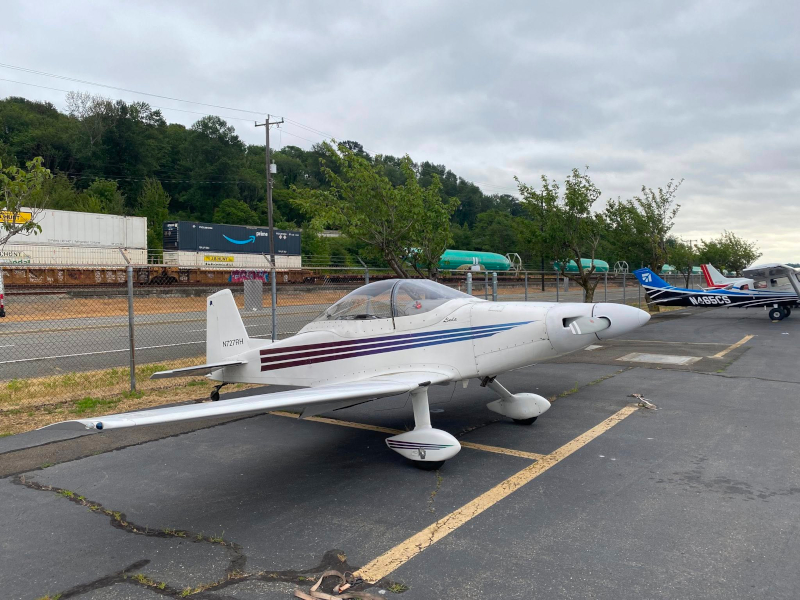
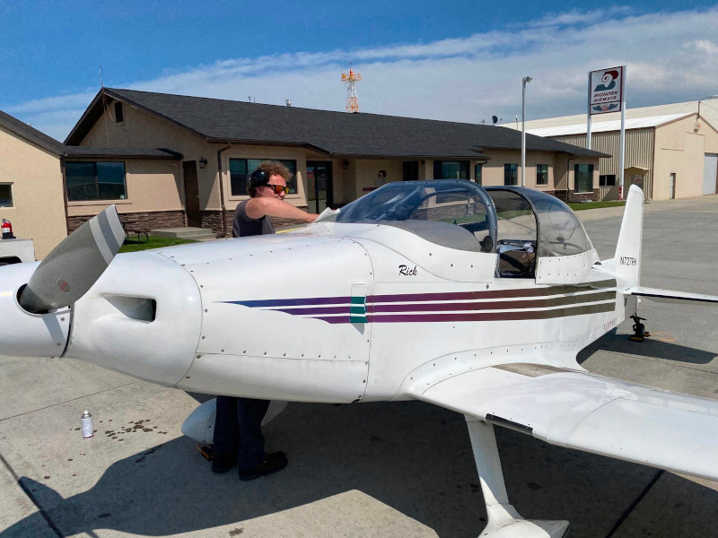
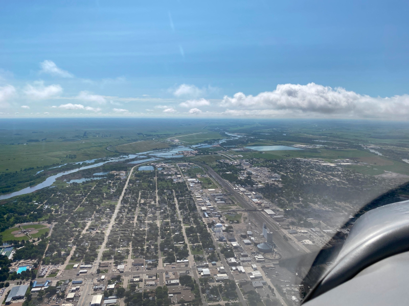
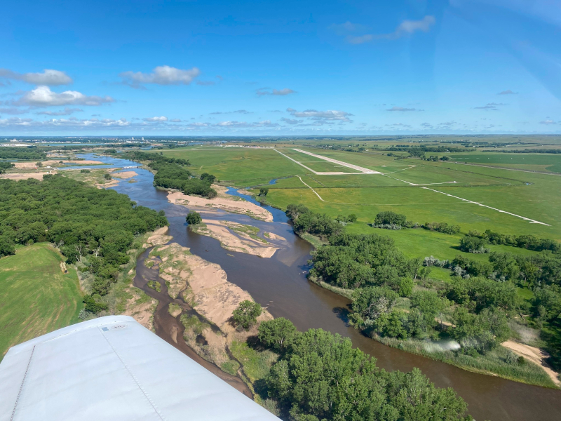
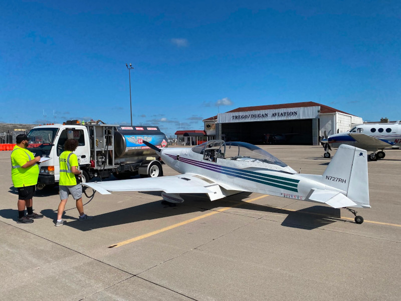
Part 2
Experimental Airplane - N727RH

Updated July 4, 2025

WARNING: Proper flight planning and preparation is required for all flights to and in Alaska.
Attempting to fly this route or duplicate this trip would obviously be AT YOUR OWN RISK.
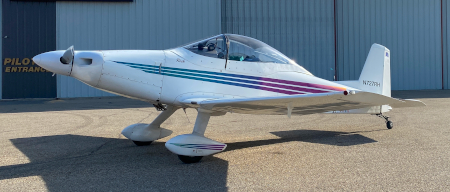
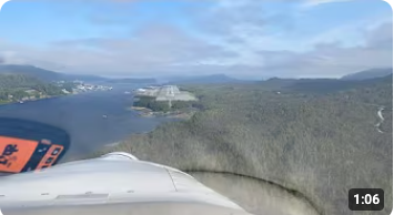


Link to YouTube video
YouTube Video clips
  New


    To slew ahead click on the sections below:

Part 1
Part 2
Route from Alaska to MS as flown- June, 2025 - Click for larger image
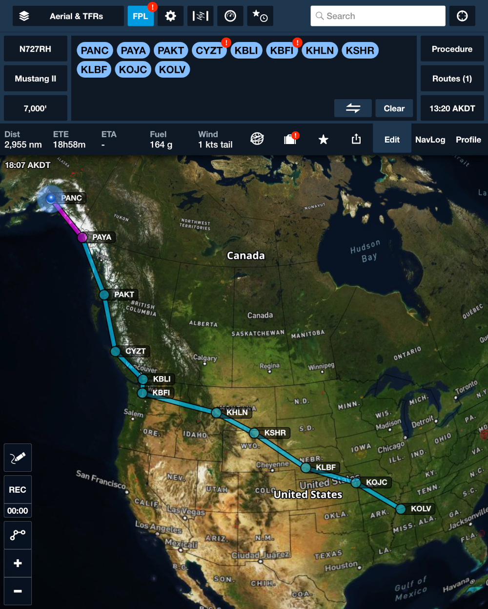
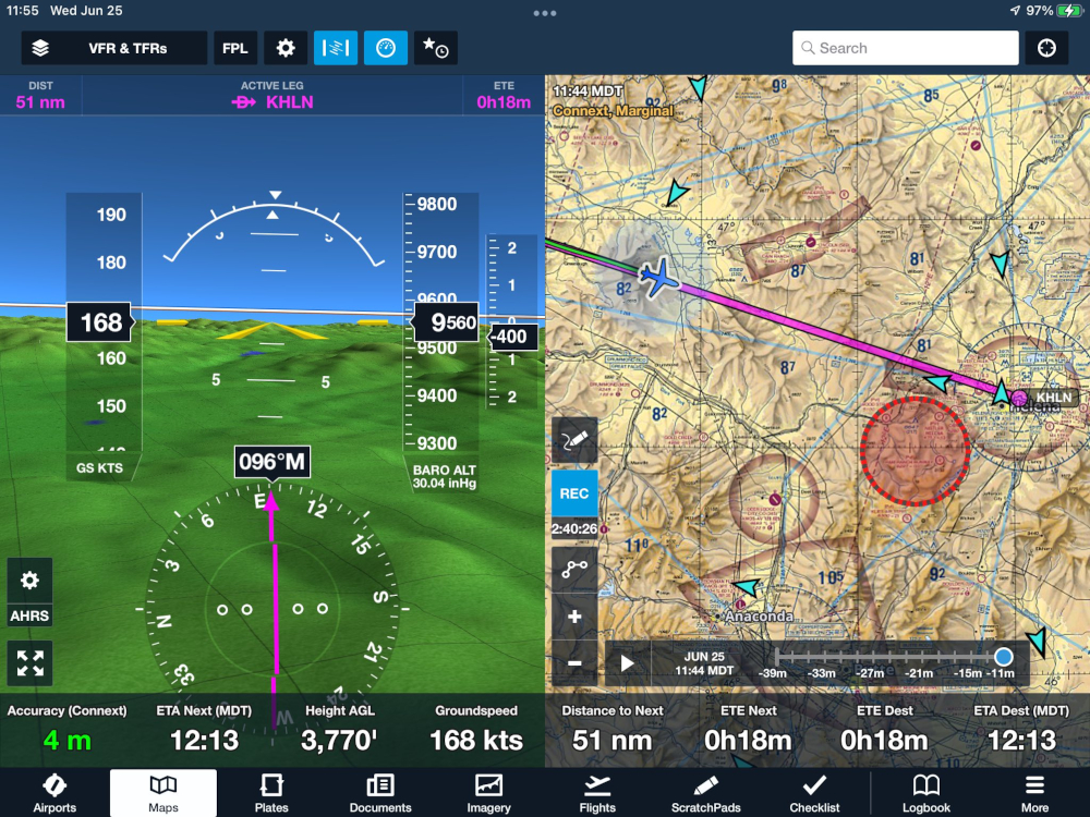
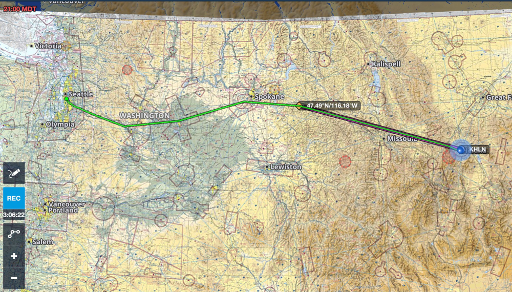
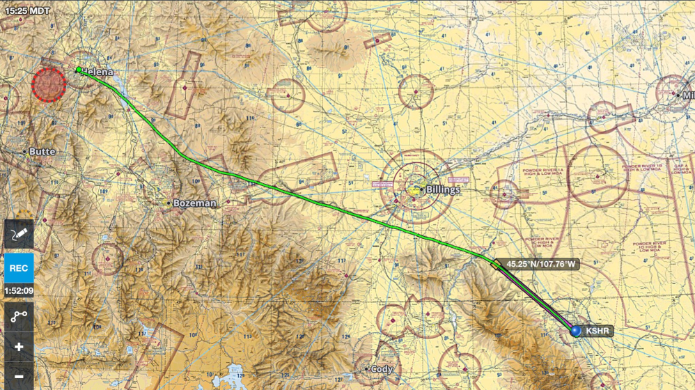
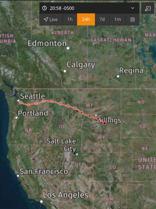
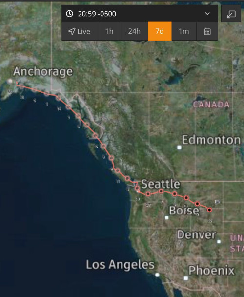
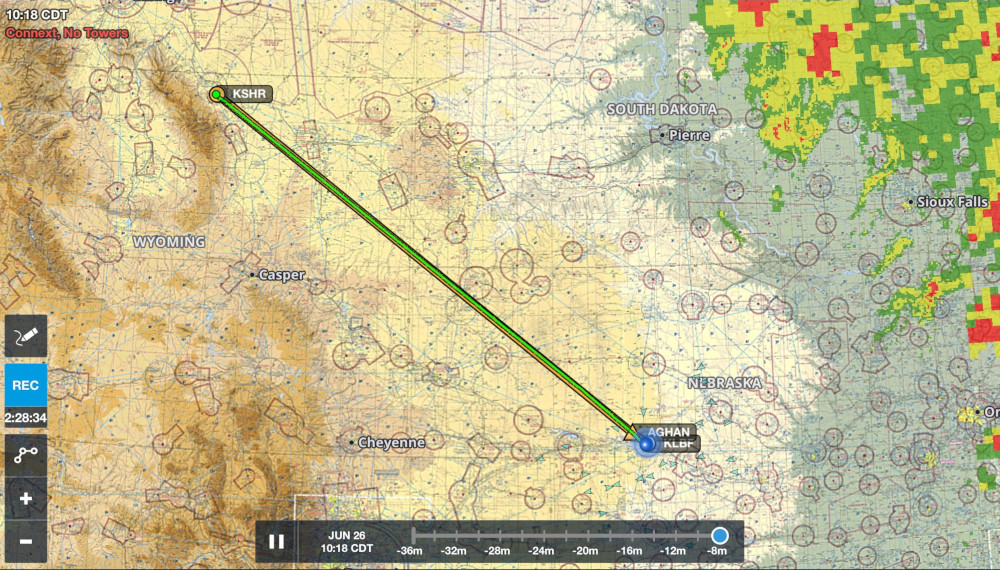
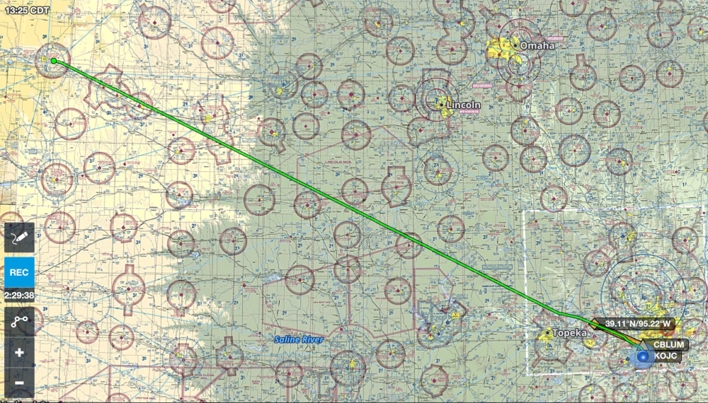
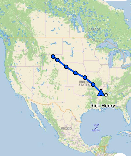
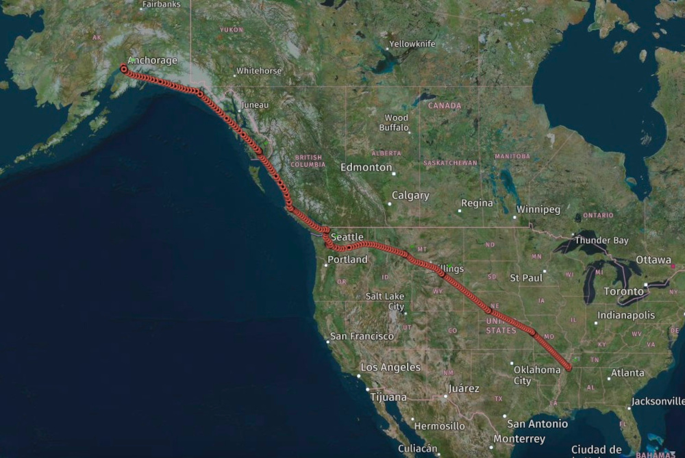
2025 Route
Click for larger image


    Previous Alaska pages:


Part 2


-- Wednesday, June 25, 2025 -- Day 4

Flight leg 6 - Boeing Field, Seattle, WA [KBFI] - Helena, MT [KHLN]

    Departed Boeing Field (Seattle) flying IFR [Instrument Flight Rules] originally headed to Missoula, MT, but I had good tailwinds and good weather so decided to keep going and after 2+44 landed at Helena, MT and had lunch there.


Parked at Boeing Field. Notice the four green Boeing 737 fuselages on the rail cars behind.


Climbing out through the clouds over Seattle.


The view in the cockpit east of Seattle


Selfie on top at 9,000'


Mount Rainier (14,410') passing on the right side


The central valley and Columbia River in Washington State.


Entering the Rocky Mountains east of Spokane.


Missoula, Montana on the right as I passed it and continued to Helena instead


The view on the iPad 50 miles west of Helena. I was VFR at 9500 feet at this point.


The route I ended up flying from Boeing Field nonstop to Helena, Montana.


On the ground in Helena.


The cockpit temperature in Helena after I came back from lunch with the canopy closed.
45.3° C is 113.5° F!


Flight leg 7 - Helena, MT [KHLN] - Sheridan, WY [KSHR]

    Departed Helena VFR [Visual Flight Rules] originally headed for Gillette, WY zigzagging a little through the mountains to miss the higher peaks. There were thunderstorms building at Gillette so after conferring with the family who were tracking me, I decided to land short at Sheridan, Wyoming for the night.


The view of Helena, Montana as I departed heading to Wyoming


On downwind for runway 33 at Sheridan, Wyoming.
Notice the large thunderstorms in the distance to the southeast.


The route from Helena to Sheridan doing some zigging through the mountains.


I cannot remember ever having the windshield cleaned by a Fixed Bace Operator -
but they do that at Bighorn Airways in Sheridan!


Main Street in Sheridan Wyoming. Enjoyed some Mexican food here.


Today's route as seen on the SPOT tracker


Total route since leaving Anchorage as seen on the SPOT


984 nautical miles to go - about 6/12 hours if there were no thunderstorms along the way...


Total flight time today was 4+20. Total flight time for the trip so far is 13+49 minutes, 15+37 block time, 15.6 hours Hobbs time. Just under 1,000 nautical miles to go to get to the Memphis area. But the mid section of the country is full of thunderstorms, so tomorrow will be a bit more challenging. I literally had no idea where I was going to wind up tomorrow night.


-- Thursday, June 26, 2025 -- Day 5 -- Final Day


Flight leg 8 - Sheridan, WY [KSHR] - North Platte, NE [KLBF]

    I got up much earlier than I normally do in order to try and beat the thunderstorms. First leg would be to North Platte, NE, to stay slightly south to later go between thunderstorms between Iowa and Wichita, KS.


Airborne off Sheridan, WY at 7 am headed directly to North Platte, NE.


Approaching fog in eastern Wyoming


Western Nebraska


Patchy fog as I was approaching North Platte, NE.
I set up for an RNAV approach


The fog cleared as I got close to North Platte, NE


The Platte River at North Platte, Nebraska
Landing on runway 30


Leg 1 of 3 for today. Cleared direct.


Parked at North Platte, NE. (KLBF)


Flight leg 9 - North Platte, NE [KLBF] - Olathe, KS [KOJC]

    At North Platte, I studied the movement of the thunderstorms and picked an airport between them that was about half way to Memphis. I had never been to Olathe - the home of Garmin avionics, so filed for a direct route there. Took off from North Platte at 11:27 AM.


Enroute at 7,000 between North Platte, NE and Olathe, KS.
About 12:10 pm Central Time. Getting hot in the cockpit.


There were some thunderstorms in the distance northeast
and southwest of the route enroute to Olathe, KS


On the ground at Olathe, KS showing the direct route flown


Flight leg 10 - Olathe, KS [KOJC] - Olive Branch, MS [KOLV]

    Landed at Olathe, KS at 1:23 and I was now only 2 1/2 hours from home, so quickly filed IFR and was on my way in just 30 minutes. Thunderstorms were forecast, but I had plenty of fuel and alternate airport options. Taxied out at 1:57 and took off at 2:02 PM.


Enroute - western Missouri


Between Olathe and Memphis, the cumulus were beginning to build and I climbed to 9,000'.


I was concerned about a large area of thunderstorms just southwest of Memphis that was building mid-afternoon.
I was concerned about it moving northeastward (as they usually do), but communicating with my family on the InReach device,
they said it was staying stationary.


I did minor deviations to avoid the bumps in the developing cumulus


Over Arkansas - the thunderstorms southwest of Memphis
were coming into view about :15 before landing


In addition to the thunderstorms west and south of Memphis that I was concerned about, a thunderstorm developed just north of Olive Branch Airport as I got close.
This one was unexpected - but stayed stationary.


In the Memphis area ATC sent me north, then east of the thunderstorm over East Memphis.
This is a screenshot of the iPad after landing.
The magenta line was the direct route, the green line was my actual track.


Mission Accomplished! All airplanes safely back in their nest.


And thankfully, we did not need to use the survival vests!


The Garmin InReach display of Flight Day 4 route:
From Sheridan, WY - North Platte, NE - Olathe, KS - Olive Branch, MS.
Today's Flight Time: 6+29, Block Time: 7+01.
Straight-line distance 984 miles. ETE 6+29


This is a screenshot of ForeFlight Wednesday evening (at 8:29)
as I started to plan Thursday's flight. ForeFlight has been very accurate for me,
but this day turned out to be quite amazing: The planning said it should take 6+29 flying time,
and incredibly, the actual total for the day was exactly 6+29 flying time!!
(7+01 block, which includes taxi time.) That probably won't happen again.


The SPOT presentation of the route from Alaska to Mississippi.
10 legs, 4 flying days,
Total Flight Time: 20:18, Block Time: 22+38


-- END --


Return to: ExperimentalAirplane.com Home